Unknown创作的日本版画《Map of Edo, Honjo Area - Kirie Zu》
艺术家:Unknown
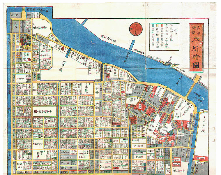
标题:Map of Edo, Honjo Area - Kirie Zu
日期:1855.
详情:更多信息...
来源:artelino - Japanese Prints
浏览所有24,751幅版画...
描述:
"Kiri-e Zu; Honjo E Zu" no. 28. Honjo, Fukagawa area. This map shows Sumida River on top, Ryogoku Bridge (famous for the fireworks displays in the summer) on the top left, Azuma Bridge on the top right. Top area is Asakusa, lower part shows various temples such as Honpo-ji, Daitoku-ji, Ryugan-ji etc... This is one of so-called, "Owariya Ban Kiri-e Zu". They consist of 31 folded maps of different parts of Edo, published one by one during 1850-1865 by Owariya. These were the maps people actually used to locate addresses. Red color indicates temple, shrine and Buddhist related areas. Grays are housing areas. Green is farms and forests. Several large palaces of feudal lords are indicated with their family crests.